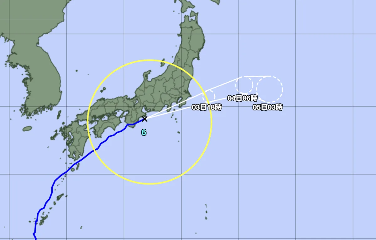
Tropical Storm Jangmi struck southern Wakayama Prefecture near the coastal city of Tanabe early on June 3, 2026, moving east-northeast at about 40 km/h with sustained winds reaching up to 126 km/h at landfall [1, 2, 3]. The Japan Meteorological Agency (JMA) issued a Level 5 flood emergency warning—the highest alert under new protocols—along the Koza River at Wakayama's southern tip [1, 2, 3].
The warnings put residents in the towns of Kozagawa and Kushimoto at high alert as riverbanks began overflowing amid heavy rainbands. The JMA highlighted the extreme rainfall risk from linear rainbands developing in southern Wakayama [1, 2]. Flooding triggered evacuation orders and Level 4 warnings for landslides and floods across multiple prefectures, including Shizuoka, Mie, Nara, Wakayama, and Tokushima [2, 3].
Around 7 a.m. JST, the storm was located just off Mie Prefecture’s coast, with sustained winds estimated up to 90 km/h and gusts reaching 126 km/h [2]. The JMA expects up to 200 mm of rain in the Tokai and Kanto-Koshin regions and as much as 120 mm in Tohoku within 24 hours ending on the morning of June 4 [1, 3].
The storm caused widespread travel chaos. Hundreds of flights were canceled, rail services were suspended or delayed, and power outages affected tens of thousands of households [3]. Several major manufacturers, including automotive companies, halted operations temporarily as a safety measure [3].
Though Jangmi weakened after making landfall, it continued moving northeast toward the Tokyo metropolitan area with heavy rain forecasts continuing into June 4 [3]. Emergency agencies remain on alert as the storm advances.
Flood conditions along the Koza River improved later on June 3, allowing some alerts to be downgraded, but authorities urged residents to remain vigilant [3]. The next rainfall forecast period ends at 6 a.m. on June 4, when further updates are expected [1].