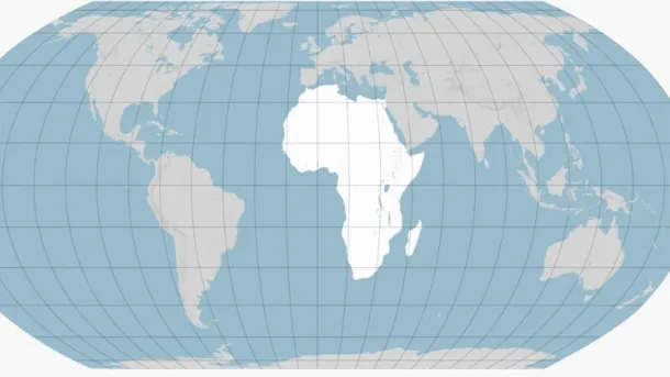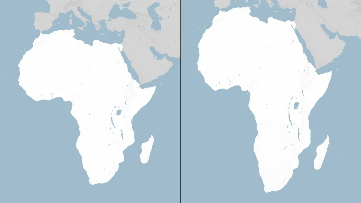
The United Nations General Assembly adopted a resolution on September 4, 2026, endorsing the Equal Earth map projection to better represent the true sizes of continents, including Africa [1, 2]. The resolution passed with 164 countries voting in favor, the United States voting against, and six abstentions from Estonia, Georgia, Lithuania, Moldova, Serbia, and Ukraine [1, 2].
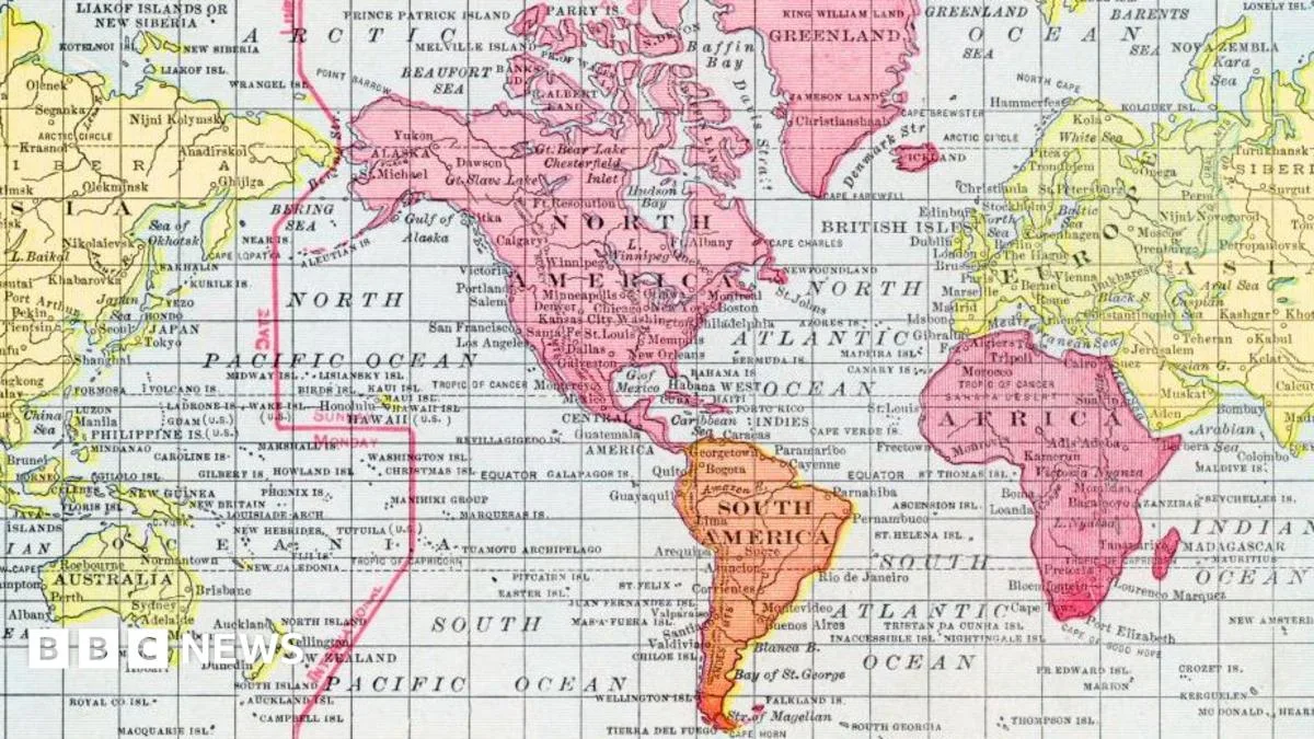
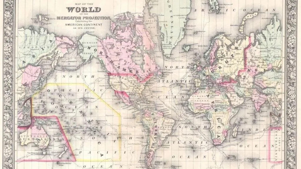
The Equal Earth projection was developed by cartographers in 2018 to preserve the relative area of landmasses more accurately than traditional maps [3, 4, 1]. Unlike the Mercator projection created in 1569 by Gerardus Mercator, which distorts the sizes of continents to keep compass bearings straight, the Equal Earth map sacrifices some navigational features to maintain size accuracy [3, 4, 5]. Professor James Cheshire explained, "He wanted a straight line to be drawn on a map to look like a straight line in reality if you followed a compass bearing. That was what it was intended to do, and that's what it does brilliantly well" [3]. However, "You can keep area constant, or shape constant, or distance and direction constant, but you cannot do all perfectly at once, otherwise you'd just have a globe again," he added [4].
The Mercator map inflates regions near the poles, making Africa appear roughly the same size as Greenland, despite Africa being about 14 times larger. According to the Equal Earth projection, Africa covers approximately 30.3 million square kilometers — large enough to contain the US, China, India, and most of Europe combined [3, 4, 1, 5]. Kenyan geographer Kioko Muendo said, "Maps are more than just guides for travellers - they shape how regions are perceived politically and economically," leading to underestimation of Africa's resources and opportunities [3, 4, 5].
Togo Foreign Minister Robert Dussey said, "The resolution adopted today reaffirms African reality" and added, "A fair map does not change the geography of the world; it changes how we see the world. And when our perspective becomes more just, it paves the way for greater understanding, respect and peace among nations" [1, 2].
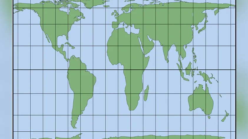
The resolution does not require governments or businesses to abandon the Mercator map but establishes UN support for equal-area maps to improve accuracy [2]. The Peters world map, created in the 1970s, is another equal-area projection but distorts shapes and is not navigationally accurate [4, 5].
The US opposed the resolution, with Deputy US Representative Yaryna Ferencevych calling it a "radical ideological project" that distracts from real international issues and damages the institution's credibility [2]. The vote marks further recognition of map projections’ political and psychological impact on global perceptions.
Earlier this year, in February 2026, African Union members officially adopted the Equal Earth map projection [4, 5]. The UN endorsement may encourage wider adoption internationally.